OV-1 operational view
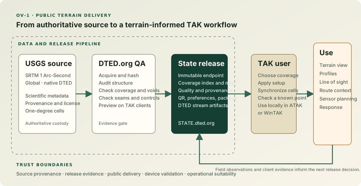
The operational view follows public terrain data from an authoritative source to a TAK user's terrain-dependent workflow. It separates source provenance, DTED.org validation and release control, public delivery, and device-level use.
Operational narrative
- Source custodians publish an elevation collection and its scientific and licensing metadata. Canonical state releases use USGS SRTM; source-specific alternatives remain independently identified.
- DTED.org operators acquire source cells, retain receipts and hashes, normalize operational heights to EGM96 when required, audit coverage and structure, preview candidates, record TAK client evidence, and explicitly promote an immutable release.
- DTED.org public services expose a state endpoint, exact coverage map, release and quality metadata, a Simple DTED Streamer index, native quadrant archives, preferences, QR setup, and an offline state DTED package.
- TAK users select a state, stream terrain or import the offline package, and validate a known point on representative hardware.
- Operational tools consume the local elevation data for visualization, profiles, line of sight, planning, navigation, and response context.
The source, release, and device-validation steps remain visible because a successful download does not establish operational suitability by itself.
Trust and failure boundaries
- Source provenance, processing transformations, and scientific limitations remain attached to the release.
- Source-specific alternatives do not silently cross the canonical SRTM baseline boundary.
- Failed or missing quality evidence is disclosed rather than converted into a passing claim.
- Public configuration artifacts contain endpoint preferences, not credentials.
- A client must verify the selected coverage and tool behavior before relying on the result.